CoastSnap beach monitoring program
CoastSnap is a community based citizen science beach monitoring program that allows Council to track changes to our coastline and beaches
Become a beach citizen scientist and help us monitor changes in our coastline over time. Download the free CoastSnap app and visit a CoastSnap station at Coolum, Alexandra Headland or Buddina and start snapping.
How to add your snap to the CoastSnap App
- Download the CoastSnap app
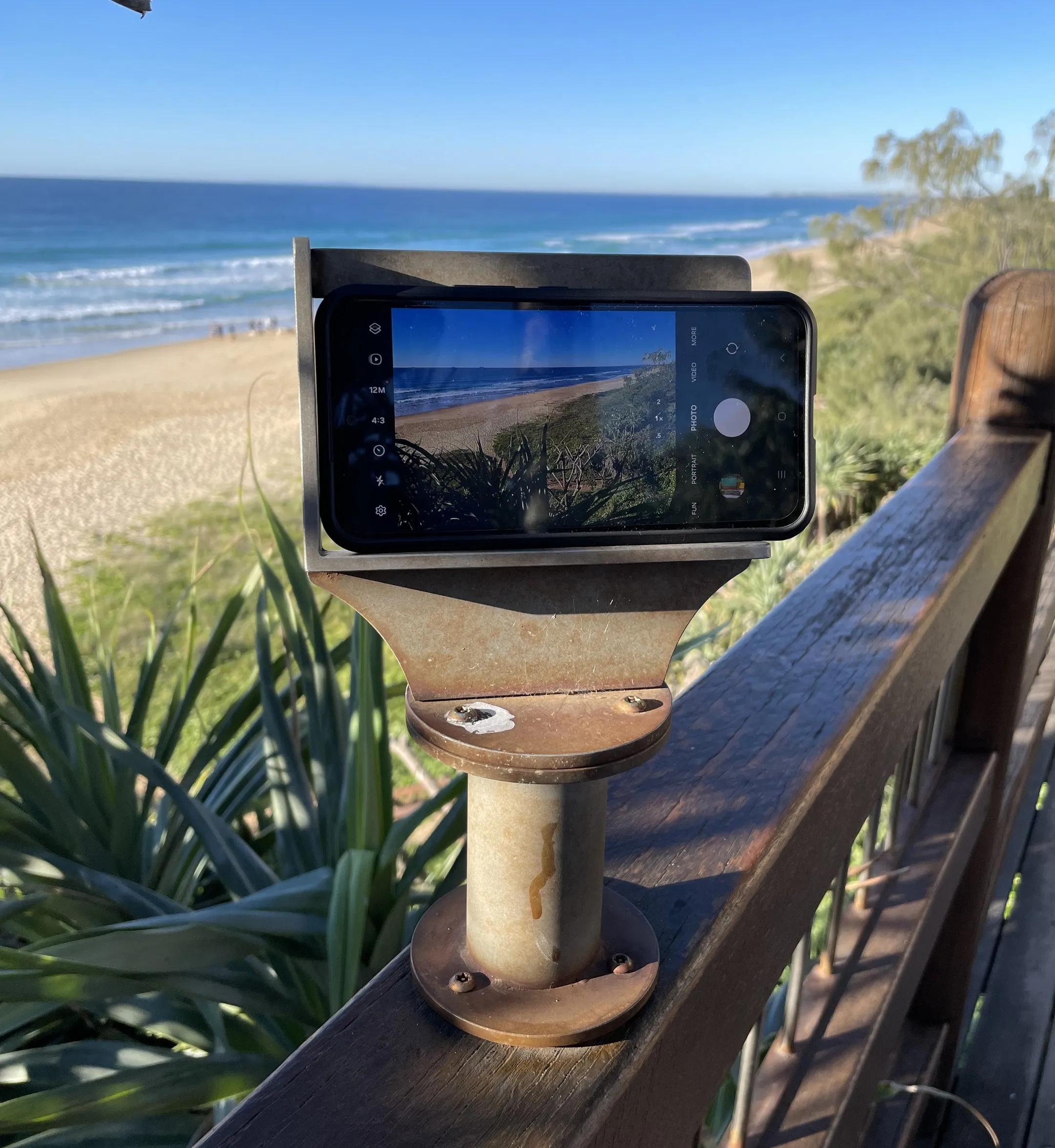
- Visit one of our CoastSnap stations
- Open the app and create an account with your email address (you only have to do this once)
- Select the CoastSnap station for your location
- Place your phone in the cradle and take a landscape photo. You can also upload a recent photo from your gallery
- Share your snap. Complete the ‘update spot’ form in the app and save your snap to submit it.
What happens to my snap
We’ll use your CoastSnap to monitor/map the way the coast changes over time. The snap is an accurate record of the shoreline and the amount of sand on the beach at that moment in time.
What we learn
The technology behind CoastSnap is able to compile the images you snap and upload them into a time-lapse video to track changes to our shoreline, giving researchers and Council’s coastal engineers insights into how our beaches change and recover after storms, big tides, severe weather, and in response to long-term environmental change such as sea level rise.
“It will provide valuable data and information to complement our current beach monitoring program to inform Council’s decision-making processes and keep our beaches healthy.”
“CoastSnap relies on repeat photos of the same location to track change so I encourage everyone to start, and keep, snapping.” - Cr Suarez
For more information visit CoastSnap.
Sunshine Coast CoastSnap locations
- Coolum Beach - Beach Access 77
- Alexandra Headland - Beach Access 156 next to Alex Skate Park
- Buddina - Point Cartwright car park, Beach Access 199