Know your local creek and catchment: Maroochy River
Creeks and catchments contain many environmental, economic, social and cultural values.
Article by Gordon Agnew, senior waterways officer, Sunshine Coast Council.
A catchment is like a natural bathtub. It’s an area with a natural boundary (typically formed by ridges, hills or mountains) within which all surface water drains from higher areas to a common creek or river channel at the bottom. Our larger catchments are made up of smaller areas called sub-catchments which are like smaller bath tubs.
The Maroochy River sub-catchments include: Eudlo Creek, Paynter Creek, Petrie Creek, South Maroochy River, North Maroochy River, Yandina Creek, Doonan-Coolum Creek, Coolum coastal creeks, Upper Maroochy estuary, Cornmeal Creek, and Lower Maroochy estuary.
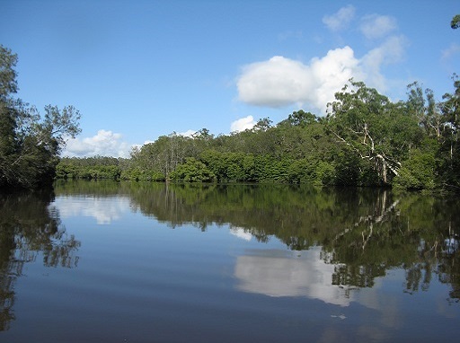
The 638km2 Maroochy catchment has its headwaters in the Blackall Range and has a network of streams covering approximately 1,436km. The major tributaries include the North and South Maroochy Rivers and Petrie, Paynter, Eudlo, Yandina, Doonan and Cornmeal Creeks. Annual rainfall is generally around 1,500 - 2,000mm.
The catchment contains many environmental, economic, social and cultural values. Urban development and residential living are strong drivers of the local economy. Fertile soils support grazing, together with horticulture, cropping and intensive animal husbandry. There are small areas of mining and quarrying scattered across the catchment, including hard rock, gravel and sand, Key Resource Areas (KRAs).
Public nature refuges and other conservation and natural areas can be found within the catchment with Mapleton National Park being the largest protected area. These open space areas provide recreational opportunities such as walking, bike riding and bird watching while the waterways support swimming, fishing, motor boating, paddling and many other water-based activities.
The freshwater rivers, creeks and wetlands of the catchment provide habitat for specialised animals such as fish, birds, turtles and platypus. Estuarine areas, including the Maroochy River Fish Habitat Area (FHA), support seagrass, intertidal flats, mangroves and saltmarsh ecosystems. These provide habitat for migratory birds, fish, turtles, dolphins and many other species.
The catchment supports a range of native and introduced fauna including, 42 amphibians, 96 reptiles, 44 fish, 440 birds and 106 mammals.
The catchment is underlain by mostly low permeability rock in the north, and sedimentary rock in the south with basalt in the upper reaches. On lower lying lands there is alluvium and other unconsolidated sediments.
Historically, most of the catchment was covered by wet eucalypt forest, dry eucalypt communities, rainforest and scrub, melaleuca woodland, coastal communities including heath, mangrove and saltmarsh.
For more information please contact council's Waterways and Catchment Management Unit via customer service on 5475 7272.
References:
- Maroochy and Mooloolah Catchments Story, WetlandInfo 2017, Department of Environment and Science, Queensland. http://wetlandinfo.des.qld.gov.au.